


A History of the Panoramic View in Four Parts: Part II Washington DC
January's special offering from Tesserae celebrates the 50th Anniversary of the second Landsat satellite launch. Let's look at our history of taking the big picture.

Last week I wrote about this month being the 50th anniversary of Landsat 2 and why satellites are only the latest way we have of getting the big picture of our places on the planet. This week I continue Tesserae’s special project in January with my second offering, a history of panoramic views of the National Mall in Washington DC.
I lived in or around DC for more than three decades while I worked for NOAA. There are many things that you can legitimately complain about the city (the traffic! the construction! the cost of living!) but I also loved aspects of living there. One of them was the National Mall downtown, which runs from the Capitol Building to the Washington Monument and connects the most iconic museums in the capital.
The National Mall, although not always under that name, had been planned as the center of the city’s life since the earliest plans under Pierre L’Enfant, a Grand Avenue that connected all the major buildings, monuments, and museums of the young American government. The federal government acquired the land from private landowners for that purpose. Some were eaten away in early development, but the Washington Monument was begun in 1848 (completed in 1884 after a more than two-decade break), and the first building—the red brick edifice we now call the Castle—of what would become the Smithsonian complex of museums was completed in 1855, spurred on by the unexpected legacy of half-million dollar fortune left to the US by Englishman James Smithson.
Federal office buildings and other structures were erected along the edges of the Mall in ensuing years. What is now the Smithsonian's Arts and Industries Building was first erected as the National Museum in 1878. The Freer Gallery was added in 1917. The Lincoln Memorial was finished by 1922. The West Wing of the National Gallery was completed by 1941.
During the Civil War, the Mall was transformed into a military installation, housing encampments, barracks, hospitals, and temporary offices, and required major restoration after the war was over. In World War I and World War II, temporary buildings were constructed to house military and civil operations related to the war efforts. Those for the first were erected about 1916 and demolished about 1930; those for the second went up about 1943 and were razed in the late 1960s.
The 1970s saw a spate of completion of the iconic museums we revere today: the Hirshhorn in 1974, the National Air and Space Museum in 1976, and the East Wing of the National Gallery of Art in 1978. The Sackler Gallery and the Museum of African Art joined them in the 1980s. The Museum of the American Indian opened in 2004, and the Museum of African American History and Culture in 2016. Planning is ongoing for the new National Museum of the American Latino, and the American Women’s History Museum.
A detailed history of the National Mall (up to 1993 ) by the Historic American Buildings Survey is available from the Library of Congress.
Enjoy these panoramic views of the National Mall!
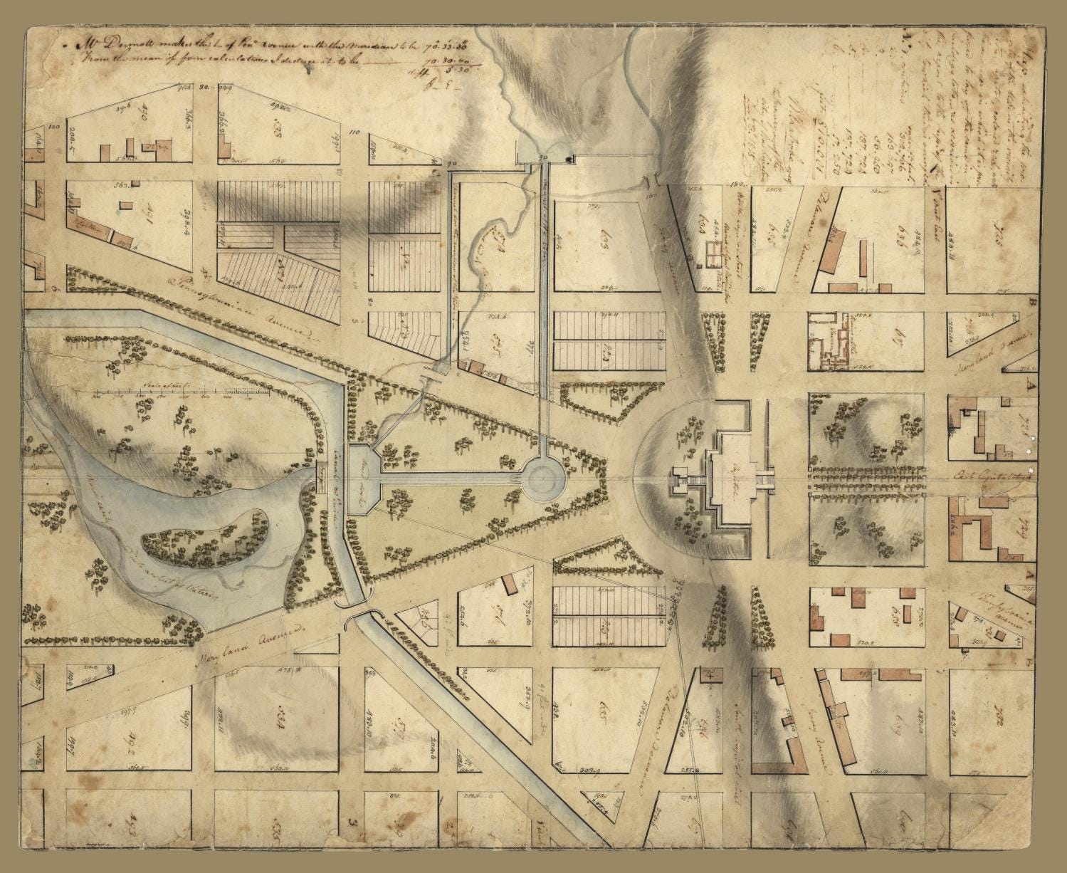
This 1815 map, from the DC Office of the Surveyor, shows what property in the vicinity of the Capitol, was owned by the US Government (reddish squares). I love the little trees the artist added!
Keep reading with a 7-day free trial
Subscribe to Tesserae to keep reading this post and get 7 days of free access to the full post archives.